In early January 2025, dry weather in Southern California sparked a series of deadly wind-driven wildfires that burned thousands of homes and other structures in the Los Angeles area.
Ming Pan, a hydrologist at UC San Diego’s Western Weather and Water Extremes Center, tracks the state’s water supply. He uses charts and maps to put Southern California's drought into perspective.
How dry is Southern California right now?
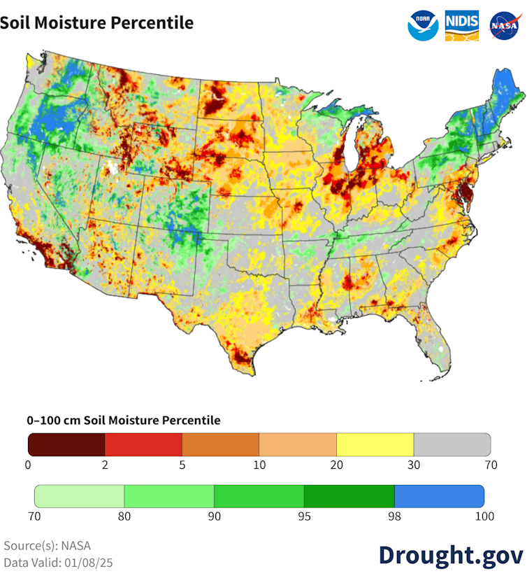
In early January, soil moisture in much of Southern California was at the lowest 2% ever recorded for the region. This is very low.
California hydrologists keep a close eye on the skies starting in October, when California's water year begins.
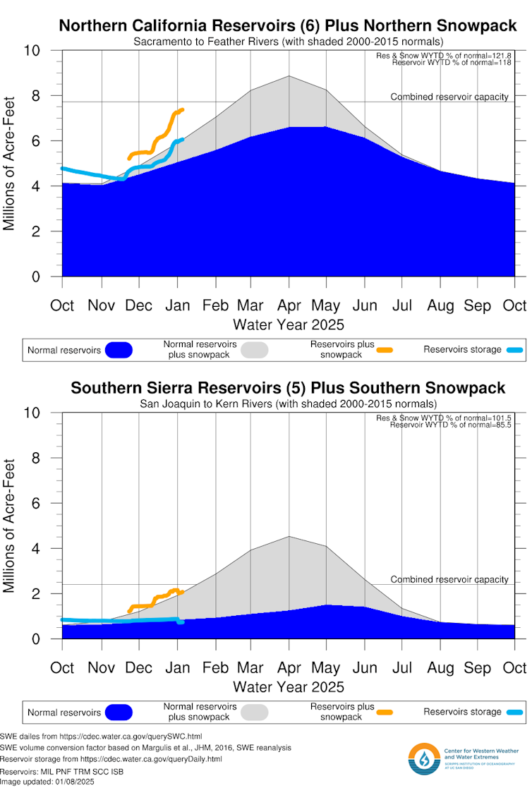
The state receives very little rainfall from May through September, so late fall and winter are critical for filling reservoirs and providing water from the snowpack. California relies on mountain snowpack for about one-third of its freshwater supply.
However, Southern California is quite dry at the start of the 2024-25 water year. In November, the region received some rainfall from an atmospheric river, but not much. Thereafter, most of the atmospheric rivers that hit the West Coast from October to January turn north toward Washington, Oregon, and Northern California.
Transpiration and evaporation also pull moisture from plants and soil when the air is warm and dry. As seen in the Los Angeles area in early January, dry vegetation can provide fuel for flying embers that can spread wildfires.
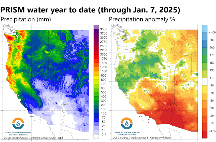
So while Northern California has good water and snowpack conditions, Southern California is much drier and has poor water storage.
In early January, snowpack began to fall below normal in the southern mountains.
What’s going to happen in California during the rest of 2025?
The U.S. Climate Prediction Center's seasonal outlook for March suggests drought conditions are likely for the region in the coming months.
The outlook takes into account forecasts of La Niña, an ocean temperature pattern in the Pacific in early 2025. La Niña conditions tend to mean drier conditions in Southern California. However, not every La Niña affects California in the same way.
A big rain or two could drastically change Southern California's water situation. In 2023, California experienced atmospheric rivers in April.
So it's difficult this early in the season to predict how dry Southern California will be in the coming months, but it's clear people in dry areas need to be aware of the risks.